Over the course of a month, we traveled thousands of miles across the Pacific, from Hawaii to Guam, through Saipan and Tinian, on to Palau, and finally to Japan. It was an unusual itinerary that brought together places we had long wanted to visit but that turned out to have far more in common than we expected. We walked through battlefields and stood on runways that helped shape the outcome of World War II, swam among jellyfish in an isolated marine lake, snorkeled by a Japanese Zero resting beneath the Pacific, explored tropical islands where remnants of the war still lie in the jungle, and experienced places ranging from tiny Pacific communities to the heart of Tokyo. At times the trip felt like an expedition, at others a history lesson, and sometimes just an extraordinary family vacation. This is the story of our journey across the Pacific.
Part 1 - Introduction
Originally, this trip was intended to center around Palau. I had been wanting to visit Jellyfish Lake for years, and that was the impetus for the trip. While searching for flight options, I found what I considered to be relatively inexpensive first-class award flights from Honolulu to Palau, which meant that Honolulu would be our positioning stop. Fortunately, I waited too long to book, and the lower-priced award availability from Honolulu to Palau disappeared. However, inexpensive award flights were still available from Honolulu to Guam.
As I began researching Guam and the surrounding area, I quickly realized that there was much more to this part of the Pacific than Palau alone. What initially seemed like a setback ultimately led me to put together a much more extensive itinerary, one that would take us to Hawaii, Guam, Saipan and Tinian, Palau, and, eventually, Japan.
Initially, Japan wasn't part of the plan. I had intended to return to Hawaii after Palau to work on a business project that I had started there. (I will hopefully be able to share some exciting news about that project in the near future as it develops.) As the trip took shape, though, I realized that I wouldn't have enough time to accomplish what I needed to, particularly with the rest of the family there. Since everyone else wanted to return to Japan, and there was a direct flight of only about four and a half hours from Palau, we decided to make Japan the final stop on our month-long journey.
Most of the flights were relatively straightforward, with the exception of getting from Saipan to Palau. There were no direct flights between the two islands, so we had to connect through Guam. That itself wasn't an issue, but for the dates we needed, the only available flight from Saipan to Guam departed early in the morning, while the flight from Guam to Palau didn't leave until late that night. The late departure to Palau was timed to connect with United's flight arriving in Guam from Honolulu, leaving us with an unavoidable all-day stopover in Guam. Because the two flights were so far apart, I had to book them as a multicity itinerary, paying the full award price for each leg. The timing was less than ideal, but there really wasn't another option.
With the exception of our flight from New York to Honolulu, which was booked using a combination of cash and United TravelBank funds that I had been saving for years, all of our flights were booked using United miles. Our hotels were reserved using a combination of cash and points. Because we needed accommodations with a kitchen at every stop, our hotel options were somewhat limited, but I was ultimately able to find something that worked in each location. With a month's worth of flights and hotels finally pieced together, our adventure across the Pacific was ready to begin.
Part 2 – The Journey Begins: On the Way to Honolulu
Our flights gave us access to the Polaris Lounge at EWR, which provides a variety of kosher meals. Since we had a very early morning flight, the meals were much appreciated:
Clockwise from top left: (i) gourmet cheese pancakes; (ii) kosher menu; (iii) challah french toast; (iv) roasted salmon; and (v) eggplant parmesan.

And then we were off on our flight:
Clockwise from top left: (i) lie flat seat; (ii) kosher meal - salmon; and (iii) amenity kit.

Our flight to Honolulu included a stopover in Los Angeles. The first flight, from New York to Los Angeles, had the more typical lie-flat business-class seats that we were used to. The second flight, from Los Angeles to Honolulu, however, had a bizarre configuration that we had never encountered before: two forward-facing seats and two rear-facing seats arranged directly opposite one another. Here are a few pictures of the seating arrangement and the kosher meal we received.

Part 3 - No R&R In Honolulu
Since we had ample time for this trip and didn't want to rush from place to place, I planned to spend a few days relaxing in Honolulu before continuing on to the next leg of our journey. For our stay, we reserved our favorite hotel in Honolulu, the Ritz-Carlton Residences. Although the hotel isn't directly on the beach, the rooms have kitchenettes with full-size refrigerators as well as their own washers and dryers. Having both of those amenities in a luxury hotel makes the Ritz-Carlton Residences our number-one choice whenever we stay in Honolulu. I reserved only one room using Marriott points and bribed the kids not to complain about the sleeping arrangements. The deal was simple: if they could survive three nights together in one room without complaining, they would each receive $100 in spending money for souvenirs in Japan. This was considerably less expensive than reserving a second room, and I'm happy to report that the bribe worked perfectly.
Information about the Ritz Carlton Residences can be found here:
Clockwise from top left: (i) our room; (ii) view from the lanai; and (iii) the pool.

As some of you already know, we've been to Oahu several times in the past, so I wasn't particularly concerned with fitting in a lot of sightseeing. My plan was simply to rest, relax, and enjoy some downtime before moving on to Guam. DW, however, had other ideas and put together an itinerary that turned out to be less relaxing than I had envisioned.
On our first day, we returned to the Bishop Museum, which we had last visited in 2017. The kids were much younger then, so DW decided that, eight years later, it was worth another visit. There was also one thing we had missed during our previous visit: the museum's lava demonstration, which DW had really wanted to see. Considering that we've seen the real thing many times, I'm not entirely sure why a lava demonstration was so high on DW's list, but she was determined not to miss it this time.
For those of you who aren't familiar with it, the Bishop Museum is considered the premier museum devoted to Hawaiian and broader Pacific history and culture. Information about the Bishop Museum can be found here:

The Kahili Room contains a collection of elegant feather standards (tall, ceremonial staff topped with a bushy cylinder of feathers that symbolizes royalty, nobility, and divine power) used to guard the high chiefs of the Hawaiian Kingdom. Clockwise from top left: (i) description of the Kahili Room; (ii) view of portraits and feather stands; (iii) and (iv) King Kamehameha The Great; (v) and (vi) King Kamehameha V.

Viewing the lava demonstration with real molten lava poured from a 2,000°F furnace.

On the following day, we visited Iolani Palace, the official residence of Hawaiʻi’s last reigning monarchs and the center of the Kingdom’s political and social life until the overthrow of the monarchy in 1893. Somehow, despite all of our previous trips to Oahu, we had never visited the palace.
Information about Iolani Palace can be found here:
From the outside, Iolani Palace doesn't look quite like the type of royal palace most of us probably picture. Rather than being enormous and overwhelmingly ornate, the building is elegant and relatively modest. Completed in 1882 for King Kalākaua, the palace served as the official residence of Hawaii's last monarchs and remains a striking reminder that Hawaii was once an independent kingdom.

Once inside, you are greeted by an ornate staircase, made from Hawaiian koa wood. Unlike many of the palace furnishings, which were dispersed after the overthrow of the monarchy and have gradually been recovered or reproduced, the staircase is part of the original palace itself.


The Throne Room was the largest and most formal room in the palace, lavishly decorated in crimson and gold. It was here that King David Kalākaua and Queen Kapiʻolani received guests and dignitaries, and where formal audiences, diplomatic receptions, and state balls were held. Interestingly, although the elaborate thrones were made for the King and Queen, they apparently preferred to stand while receiving their guests rather than sit on them. There is also a much darker piece of history associated with the room: Queen Liliʻuokalani's trial took place there after the overthrow of the monarchy.

Clockwise from top left: (i) King Kalākaua's bedroom; (ii) decorative Victorian door hinge; and (iii) the State Dining Room.

One particularly interesting sidenote about King Kalākaua, the last reigning king of Hawaii, is his unlikely friendship with Elias Abraham Rosenberg, a Jewish immigrant to the United States with a rather colorful—and somewhat questionable—past. Rosenberg became a trusted friend and adviser to the King, sharing stories from the Bible and teachings from the Talmud with him and even beginning to teach him Hebrew. Before leaving Hawaii, Rosenberg presented Kalākaua with an ornate Torah scroll and yad (Torah pointer) that he had brought with him to the islands.
After finishing our tour of Iolani Palace, we headed toward Diamond Head for our hike, stopping along the way for lunch at a random spot next to what appeared to be a park. There were some chickens wandering around, and I decided to amuse Little One by chasing them. In the process, a fellow sitting in a nearby car called me over and proceeded to regale me with stories about his rather colorful life—and, eventually, with some observations about mine.
Apparently, his father was Jewish, he was involved with the Oahu Jewish community, and he was in regular contact with Rabbi Krasnjansky. He had also previously been married to a Japanese woman from a wealthy family. When that marriage ended, her family paid him handsomely to go away and never come back. Undeterred, he had since remarried—this time to another very wealthy, older woman. There is quite a bit more to his story, but some of it is probably best left out of this trip report.
After sharing all of this with me, he turned his attention to my future. Despite the fact that we had never met before and he knew absolutely nothing about me, he confidently informed me that I should move to Hollywood because I would be very successful there. I'm still not entirely sure what he saw in me, but the conversation was, at the very least, amusing. I could have stayed and chatted with him all day, but we had a timed entry at Diamond Head, so eventually I had to tear myself away.
Diamond Head now requires an advance reservation, and since we had dilly-dallied before making ours, we ended up with a time slot in the middle of the afternoon—just in time for the hottest part of the day. Although DW and Oldest Kid had hiked Diamond Head on a previous trip, the rest of us had never done it. The hike is advertised as strenuous, but we didn't find the trail itself particularly difficult. The real challenge was the heat, which made an otherwise manageable hike considerably more exhausting.
Information about Diamond Head can be found here:
Clockwise from top left: (i) entrance sign; (ii) and (iii) views from the top; and (iv) on the way up.

After making our way back down Diamond Head, our brief stay in Hawaii was essentially at an end. Honolulu had been the familiar part of this trip—a place we had visited several times before and, at least in my original plan, an opportunity to relax before the real adventure began. Admittedly, thanks to DW's itinerary, there had been considerably less relaxing than I had envisioned, but we had managed to revisit the Bishop Museum, finally explore Iolani Palace, and survive a very hot afternoon hiking Diamond Head.
Part 4 - Guam: Where America’s Day Begins
The next morning, it was time to leave familiar territory behind. We headed back to the airport, boarded our flight, and began the journey west across the Pacific. Next stop: Guam.

Clockwise from top left: (i) waiting for our flight; (ii) lie flat seat; and (iii) and (iv) Bornstein kosher meal.

As many of you know, airline kosher meals can be something of a culinary lottery. Sometimes they're surprisingly good, sometimes they're barely edible, and occasionally you wonder whether eating them is worth the risk. This particular meal, catered by Borenstein, was a mixed bag. Some of it was edible. Unfortunately, another part came with an unadvertised ingredient: mold.
After approximately seven hours in the air, we finally arrived in Guam. Our first order of business was getting ourselves—and our considerable amount of luggage—to the hotel. Finding suitable accommodations in Guam had been a bit of a challenge. Since we were traveling to places where kosher food would be difficult, if not impossible, to find, we had brought along our own supply of meat and cheese. That meant we needed accommodations with both a kitchen and a full-size refrigerator.
As it turned out, however, keeping kosher in Guam was considerably easier than we had anticipated. Although there was no Chabad and there were no kosher restaurants, the local supermarkets carried a surprisingly wide assortment of kosher products imported from the mainland United States. We still needed the meat and cheese we had brought with us, but there were plenty of other things we could buy locally. The bread situation was fairly lousy—the best use-by dates we found were only a few days away, so we passed on the bread. We did, however, find Uncrustables: prepackaged, crustless round sandwiches filled with peanut butter and jelly or other spreads and sold frozen. They made for an easy lunch and became one more unexpected convenience in a place where we had anticipated having very few kosher options.
We also discovered Infusion Coffee & Tea while we were in Guam, and everyone thought the coffee was excellent. While the other coffee shops we visited didn't have kosher milk, Infusion had kosher oat milk. We liked it enough that stopping there became part of our daily routine for the rest of our stay.
Information about Infusion Coffee & Tea can be found here:
One of the other coffee shops we visited didn't have any kosher milk. But what they did have felt like a museum devoted to coffee. If you're a coffee aficionado and are on Guam, it may be worthwhile for you to visit Slo Walk Coffee.
Information about Slo Walk Coffee Roasters can be found here:
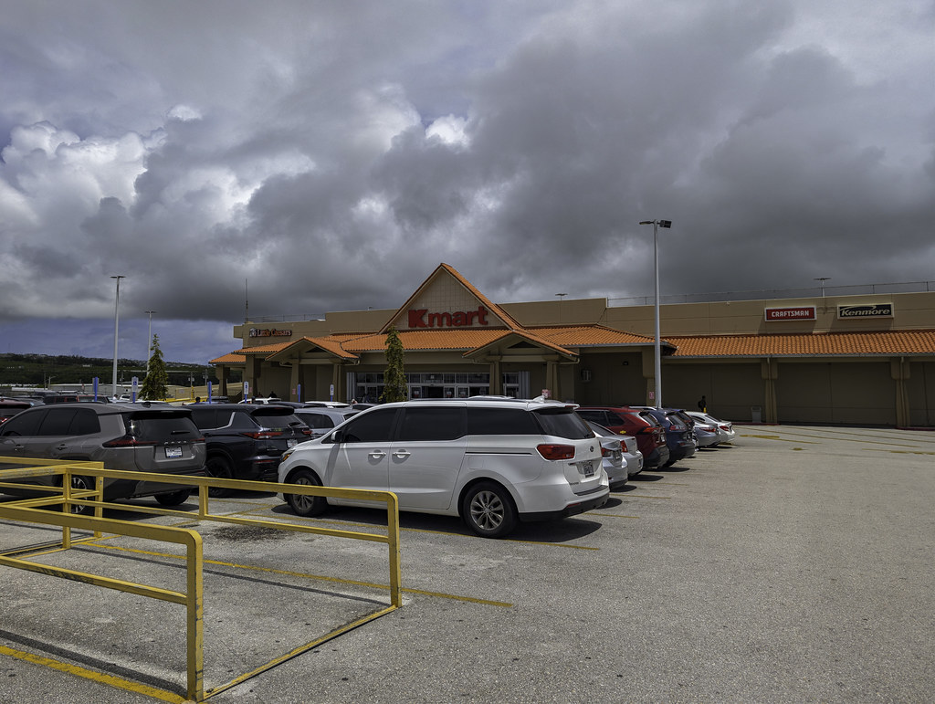
We also made time for one rather unusual Guam attraction: Kmart. Guam is home to one of only three Kmart locations still operating in the U.S. chain, so naturally we had to stop in. I can't say that I ever expected a trip to Kmart to qualify as sightseeing, but at this point, it practically does. For some of us, Kmart also brings back memories that have very little to do with shopping. I messaged my friend Sam, who immediately asked whether this location still had a financial services desk. I checked, but unfortunately was told that it did not.
Guam has some very nice resorts, but none offered the kitchen facilities we needed, so they were out of the question. After considerable searching, I finally settled on the SureStay Hotel by Best Western Guam Airport South. The cost was slightly over $200 per night, although the bulk of it was covered by the sign-up bonus I received from my Wells Fargo One Key credit card. As it turned out, this was not one of my better travel decisions. I would be hard-pressed to recommend this hotel to anyone.
I reserved a two-bedroom suite with a kitchen, but shortly before our arrival, I received a message informing me that the suite was unavailable due to water damage. I was given the choice of canceling the reservation or taking two separate rooms instead. Not wanting to hunt for another hotel at the last minute, I let them know we'd take the two rooms. To make matters worse, at check-in we were initially offered rooms on different floors. After complaining, they managed to put us on the same floor, although the rooms were still nowhere near each other. Annoying, certainly, but little did we know that this was only the beginning.
Our rooms were on the fourth floor, and after bringing all of our luggage into the lobby, I looked over at the elevator—only to discover a big out of order sign. This meant hauling a month's worth of luggage—including all of the food we had brought with us—up three flights of stairs. After a seven-hour flight from Honolulu, you can imagine how thrilled I was about that.
Once we finally made it upstairs, things didn’t improve. After the flight and getting thoroughly shvitzed schlepping all our luggage up four flights of stairs, I was looking forward to a nice hot shower. That, too, was apparently too much to ask. There was essentially no hot water; at best, it became warm enough to take the chill off. And then there were the sheets, whose cleanliness left quite a bit to be desired.
Even doing laundry became an adventure. The hotel’s laundry facilities were out of order, so I had to haul our clothes to a nearby laundromat—which was missing its front windows and had no air conditioning—to do our loads. Between the missing suite, the separated rooms, the broken elevator, the barely warm showers, the questionable bedding, and the broken laundry facilities, it was becoming increasingly clear that my carefully selected hotel had been a spectacular failure. Suffice it to say, we were not happy campers.
Fortunately, we hadn't come to Guam for the hotel. Our primary interest in visiting the island was its World War II history. With Saipan, Tinian, and Palau also on our itinerary, Guam gave us an opportunity to explore another significant piece of the history of the Pacific War.
Guam's history, of course, stretches back long before World War II. The island has been home to the indigenous Chamorro people for thousands of years and became a Spanish possession in the seventeenth century. Following the Spanish-American War in 1898, Spain ceded Guam to the United States. Its location in the western Pacific would become particularly important during World War II.
Just hours after the attack on Pearl Harbor in December 1941, Japanese forces attacked Guam, capturing the island a few days later. Guam remained under Japanese occupation for more than two and a half years, a particularly brutal period for the Chamorro people. In July 1944, American forces returned, beginning the Battle of Guam and eventually recapturing the island. Guam subsequently became an important American base for operations against Japan and remains a strategically important U.S. territory today. With that history in mind, much of what we wanted to see in Guam centered around the events of World War II and the remnants of the war that can still be found around the island.
We began our exploration of Guam's World War II history at an overlook above Asan Beach, one of the main landing sites for American forces during the Battle of Guam. On July 21, 1944, U.S. Marines came ashore on the beaches below as part of the effort to retake the island from the Japanese. Information about the overlook can be found here:
From the overlook, we had a sweeping view of the coastline and the waters the invasion force had crossed.

Clockwise from top left: (i) “Attack, Occupation, Liberation” bronze triptych at the Asan Bay Overlook; (ii) signposts on the overlook, with arrows pointing toward major battles of the Pacific War. Each arrow gives the battle's direction from Guam, its distance, dates, and total fatalities; and (iii) Memorial Wall of Names, which commemorates not only the American servicemen who died defending and later liberating Guam, but also the people of Guam who died or suffered during the Japanese occupation and the fighting to retake the island. More than 17,000 names appear on the wall, making it a particularly powerful reminder that the Battle of Guam was not simply a military campaign—the island's civilian population was caught in the middle.

After spending some time at the Asan Bay Overlook, we continued our exploration of Guam's World War II history at the War in the Pacific National Historical Park Visitor Center. Having just looked down upon one of the principal American landing areas, the Visitor Center provided an opportunity to learn more about the battle that had taken place on the beaches and hills surrounding us. It also served another important purpose: DW could add the War in the Pacific National Historical Park stamp to her National Parks Passport book.
Information about the T. Stell Newman Visitor Center can be found here:
Clockwise from top left: (i) entrance to the T. Stell Newman Visitor Center, the main visitor hub and museum for the War in the Pacific National Historical Park in Guam; and (ii) and (iii) two-man Japanese WWII submarine and descriptive sign, located outside the T. Stell Newman Visitor Center.

Afterwards, we headed back outside to see some of Guam's World War II history firsthand. Our next stop was the Piti Guns Trail, a short trail through the jungle leading to three Japanese 140mm coastal defense guns installed in the hills above Piti during the Japanese occupation. The guns were positioned to defend against American ships and landing craft approaching Apra Harbor and, remarkably, remain in their original emplacements today.
Perhaps even more remarkable is that, despite the considerable effort involved in hauling these massive guns into position, they were never fired. The Japanese defenses were still incomplete when American forces returned to Guam in July 1944, and the guns never became operational.
Other than a few chickens, we didn't encounter anyone else during our visit and had the entire site to ourselves, which made exploring the abandoned guns in the middle of the jungle all the more interesting.
Information about this hike can be found here:
Beginning of the trail.

Fossils embedded in the rock along the trail.

The Piti Guns:


As much as we wanted to explore Guam's World War II history, we also wanted to see some of the island's natural beauty. We therefore traded the jungle and abandoned artillery for the coast and headed to Mushroom Rock Hila'an Beach, known for the unusual mushroom-shaped limestone formations just offshore. Finding the destination on Google Maps was easy enough; figuring out how to actually get down to the beach was a bit more confusing. After a little trial and error, we parked the car and followed a short path to the right of the parking area, which led us down to the beach.

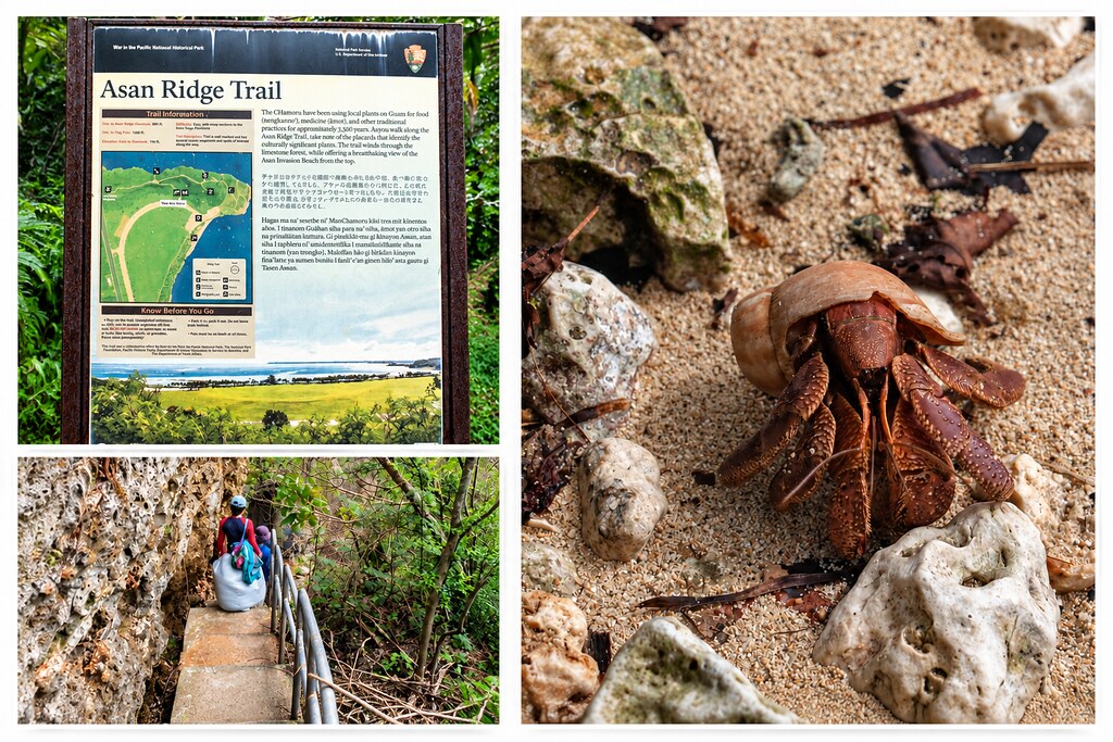
Little One had fun catching hermit crabs on the beach. But don't worry—no animals were harmed in the making of this trip report. All of the hermit crabs were safely released back onto the beach.

Later that day, we headed to Asan Beach, which we had previously seen from the Asan Bay Overlook. This time, we wanted to see the beach up close and walk along the shoreline where U.S. Marines landed on July 21, 1944, during the battle to retake Guam.
Clockwise from top left: (i) sign at the trailhead; (ii) hermit crab on the beach; and (iii) heading down to Asan Beach.
During our time exploring Asan Beach, we came across several remnants of World War II, including fragments of U.S. Navy china, fragments of beer bottles, and a spent Japanese cartridge case. They made for some pretty interesting souvenirs, which we carefully packed up and shipped home.
Clockwise from top left: (i) Japanese bunker at Asan Beach; (ii) Asan Beach; (iii) spent Japanese bullet casing and US Navy pottery that we found at Asan Beach; and (iv) fragment of a Japanese Kirin beer bottle dating to the Japanese occupation of Guam (1941–1944).

After spending some time exploring Asan Beach, we moved on to something a little different. Our next stop was Fish Eye Marine Park, an underwater observatory located out in Piti Bay. A long walkway leads from shore to the observatory, where you can descend below the surface and watch the fish and coral through underwater viewing windows. Information about Fish Eye Marine Park can be found here:
Clockwise from top left: (i) entrance to the Fish Eye; (ii) welcome sign; (iii) one of the underwater observatory windows; and (iv) Little One looking through an underwater observatory window.

Our visit to Fish Eye brought our time in Guam to a close. Although World War II history had been one of the main reasons we wanted to visit, Guam turned out to offer much more than that. Between exploring battlefields and abandoned Japanese guns, walking along beautiful beaches, and getting a glimpse of the marine life beneath the surrounding waters, we had packed quite a bit into our short stay.
Part 5 - Saipan: A Turning Point in the Pacific
The next morning, it was time to continue our journey through the Marianas. We headed back to the airport, said goodbye to Guam, and boarded the short flight north to our next stop: Saipan.
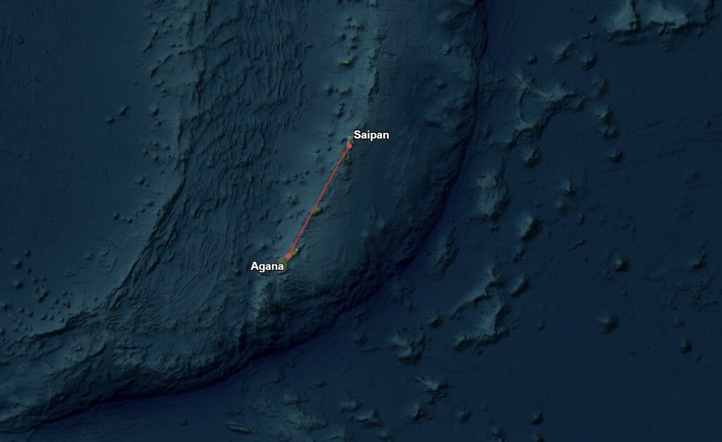
One of the main reasons I wanted to visit Saipan was actually to get to Tinian. Tinian had long interested me because of the extraordinary role this tiny island played during the final days of World War II. It was from Tinian that the B-29s carrying the atomic bombs Little Boy and Fat Man departed for Hiroshima and Nagasaki, and remnants of the massive airfields and the atomic bomb loading pits can still be seen today.
Since the easiest way for us to visit Tinian was from Saipan, adding Saipan to the itinerary made perfect sense. But as I began researching the area, I quickly realized that Saipan had an equally fascinating—and tragic—World War II history of its own. The Battle of Saipan was one of the pivotal battles of the Pacific War, and many of the bunkers, caves, guns, and other remnants of the fighting remain scattered around the island today. And, as an added bonus for DW, Saipan is home to American Memorial Park, another National Park Service site where she could pull out her National Parks Passport book and add another stamp to her collection.
The flight on United was booked with miles, and although I was offered an upgrade to first class, I declined. It was a short flight, and I preferred to sit with the rest of the family. For our stay, I booked a three-bedroom suite at the beachfront Aquarius Beach Tower Hotel, which turned out to be a very good choice. The rate was under $300 per night and included exactly what we needed: a full kitchen as well as a washer and dryer in the room. After our experience in Guam, I was particularly happy with this choice.
More information about the hotel can be found here:
Saipan is part of the Commonwealth of the Northern Mariana Islands (CNMI), a U.S. commonwealth that also includes Tinian and Rota. Interestingly, although Guam is geographically part of the same Mariana Islands chain, it is politically separate from the CNMI. The reasons for that separation are complicated, but World War II played an important role.
Before the war, Guam was administered by the United States, while Saipan and the rest of the Northern Marianas had been under Japanese rule since 1914. After Japan captured Guam in 1941, some Chamorro from Saipan and Rota were brought to Guam by the Japanese military and served as interpreters, police investigators, and assistants. Because Guam's Chamorros suffered terribly during the Japanese occupation, those from the Northern Marianas who worked with the Japanese came to be viewed by many on Guam as collaborators, creating considerable resentment between communities that shared the same Chamorro heritage.
That resentment lasted well beyond the war. When voters were asked in 1969 whether Guam and the Northern Marianas should reunify politically, voters in the Northern Marianas favored reunification, while 58 percent of Guam voters rejected it. Wartime memories were one factor in Guam’s rejection of reunification, although concerns about the economic cost of incorporating the less-developed Northern Marianas also played an important role. The islands ultimately followed separate political paths, with the Northern Marianas becoming the Commonwealth of the Northern Mariana Islands (CNMI), while Guam remained a separate U.S. territory.
The political separation is reflected in an interesting distinction that persists today. When the CNMI later adopted its constitution, it restricted permanent and long-term interests in land to people of “Northern Marianas descent”—a category based on Northern Marianas Chamorro or Carolinian ancestry. As a result, a Chamorro whose ancestry is solely Guamanian does not qualify.
Interestingly, Japan's control of Saipan actually began during World War I. Before the war, the Northern Mariana Islands were German possessions, but when war broke out in 1914, Japan entered the conflict on the side of the Allies and quickly seized Germany's islands in the Pacific, including Saipan. Over the next two decades, thousands of Japanese settlers moved to Saipan, and the island became increasingly integrated into the Japanese Empire—setting the stage for its strategic importance during World War II.
Today, Saipan feels surprisingly undeveloped in some respects, particularly for a U.S. territory. There were abandoned and deteriorating buildings scattered around the island, including some that appeared not to have recovered from previous typhoons. At times, the sheer number of abandoned structures gave parts of the island an almost post-apocalyptic feel. Even some of the basic infrastructure and services we take for granted at home work very differently there. Street addresses are not used, residents rely on post office boxes for their mail, and there is no island-wide municipal curbside garbage collection. The tap water is also not considered safe for drinking, and bottled or reverse-osmosis purified water is recommended for drinking and cooking. The island is heavily dependent on cargo ships for imported food and other goods as well. We were told that popular items can sell out quickly after a shipment arrives, and once they’re gone, residents may simply have to wait for the next ship to come in before they’re available again. None of this detracted from how much we enjoyed Saipan, but it did give the island a distinctly remote feel—and served as a reminder that life in an isolated Pacific territory can be very different from life on the U.S. mainland.
With so much we wanted to see on both Saipan and Tinian, and only a limited amount of time to do it, I decided that hiring a local guide would allow us to make the most of our visit. After doing some research online, I came across Walt Goodridge, better known as the “Jamaican on Saipan.” Walt has lived on Saipan since 2006 and operates Discover Saipan, offering personalized tours of both Saipan and Tinian.
We booked a two-day tour with Walt—one day exploring Saipan and the other Tinian—and it turned out to be an excellent choice. Having someone who knew the islands, their history, and where to find some of the less obvious sites allowed us to see considerably more than we could have managed on our own.
Walt can be reached at walt\@discoversaipan.com, or through [https://www.discoversaipan.com/](https://www.discoversaipan.com/) (Tznius warning: website contains a non-Tznius picture.)
Walt also has a Discover Saipan YouTube channel, where he posts videos about Saipan, Tinian, and life in the CNMI.
The following morning, Walt picked us up at our hotel, and our exploration of Saipan began. We had a full day ahead of us, with stops ranging from World War II battle sites and Japanese fortifications to some of the island's cultural and scenic highlights. We began the tour with an orientation and then visited the remnants of Japanese pillboxes at Micro Beach, inside American Memorial Park in Garapan.

We visited Red Beach, one of the primary landing beaches where U.S. Marines of the 2nd Marine Division came ashore on June 15, 1944, to begin the crucial World War II invasion of the island.

Walt's then and now photograph of Red Beach:

Japanese Model 89A tank, on top of a Japanese Pillbox, at Red Beach.

We saw a Sherman tank in the lagoon off Saipan's west coast near the village of Susupe. It ended up there during the initial amphibious assault of the Battle of Saipan. Three Sherman tanks became stranded a few hundred yards offshore during the invasion and were never recovered. More than eighty years later, they remain in the lagoon, where you can swim, snorkel, or take a boat out to explore them.

We then visited Susupe Beach, which, along with neighboring Oleai Beach, formed part of the primary American amphibious landing zone known as Red Beach. We saw several Japanese bunkers/pillboxes still standing along the shoreline.

Afterwards, we continued to the American Memorial Park Visitor Center, whose exhibits provided a broader look at the war in the Mariana Islands and helped put many of the places we had been visiting into historical context.
Information about American Memorial Park can be found here.
Outside the Visitor Center, we visited the Memorial Court of Honor and Flag Circle. At its center flies the American flag, surrounded by the flags of the Army, Navy, Marine Corps, and Coast Guard—the four branches that participated in the Marianas Campaign. Encircling the memorial are 26 granite panels inscribed with the names of 5,204 American servicemen who lost their lives during the fighting on Saipan and Tinian and in the Battle of the Philippine Sea. Dedicated on June 15, 1994, exactly 50 years after American forces landed on Saipan, the memorial puts individual names to the enormous human cost of the battles whose remnants we had been exploring throughout our time in the Marianas.

We also explored the Visitor Center, where the exhibits provided more context for the battles and wartime sites we had spent the past several days exploring. And, of course, DW made sure to get her National Parks Passport stamped.

We also stopped at the site of Camp Susupe, which was established by the U.S. military following the brutal Battle of Saipan in July 1944. The compound eventually held some 18,000 civilians and was divided into separate sections based on ethnicity.

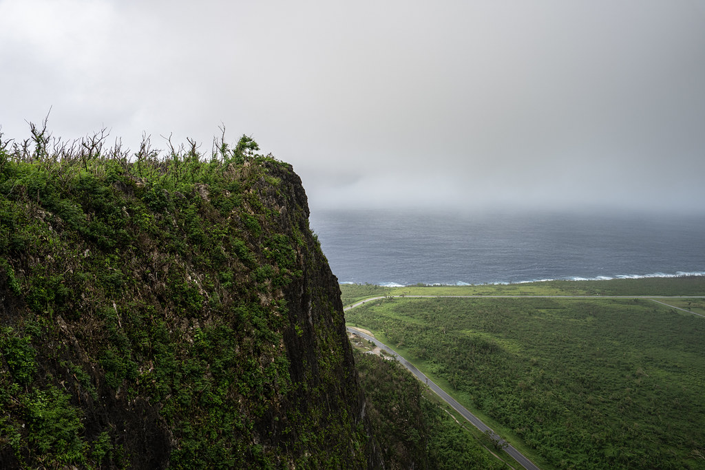
From there, we headed north to two of Saipan’s most haunting World War II sites: Banzai Cliff and Suicide Cliff. During the final days of the Battle of Saipan in July 1944, Japanese soldiers and civilians were pushed toward the island’s northern end as American forces closed in. Years of Japanese propaganda had convinced many civilians that capture by the Americans would mean torture or death. For instance, Victor Diaz recalled being told, “Americans are the very worst enemy. They will cut off your nose and ears and maybe poke out your eyes. Don’t be captured by the Americans.” See Victor Diaz, “After the War,” in We Drank Our Tears: Memories of the Battles for Saipan and Tinian as Told by Our Elders, Katharyn Tuten-Puckett, project director (Saipan: Pacific STAR Center for Young Writers, 2004), 86.
Pedro Arriola Tenoria recalled another striking example of the fear that had taken hold. He encountered a Japanese man passing by with his wife and asked him in Japanese, “[W]here are you going?” The man replied, “I heard there’s an African soldier who will eat any Japanese that he finds. I’m scared because he might eat my wife and me.” The man and his wife then ran away. See Pedro Arriola Tenoria, as told to Michelle Tenoria Cabrera, in We Drank Our Tears: Memories of the Battles for Saipan and Tinian as Told by Our Elders, Katharyn Tuten-Puckett, project director (Saipan: Pacific STAR Center for Young Writers, 2004), 176.
Against this backdrop of propaganda and intense fear of capture, hundreds—and possibly more than a thousand—Japanese soldiers and civilians jumped from the cliffs to their deaths rather than surrender, while others killed themselves and, in some cases, members of their own families. Some Japanese soldiers were reportedly terrified of what would happen if they surrendered; for others, the prospect of being taken prisoner alive carried a profound sense of disgrace. Today, both sites are dotted with memorials to the soldiers and civilians who died on Saipan.
We first visited Banzai Cliff, at the northern tip of the island.

Afterwards, we visited Suicide Cliff.
From the cliffs, we continued to another site associated with the final days of the battle: the Last Command Post. Located at the base of Suicide Cliff, the site is centered around a large natural limestone cave that the Japanese fortified and used as a command position during the final stages of the Battle of Saipan. As American forces pushed northward, this area became part of the Japanese military's last defensive stronghold on the island. The cave and surrounding limestone still bear scars from the fighting, and several pieces of Japanese military equipment—including artillery and a tank—remain at the site today.
Clockwise from top left: (i) view of the Last Command Post with artillery remnants in the foreground; (ii) Japanese Type 95 tank; and (iii) and (iv) Japanese artillery. (The weapons and other military equipment were recovered from various locations around Saipan and assembled at the site after the war.)

Photos of the exterior and interior of the Last Command Post.

Our final stop of the day took us forward several decades in Saipan's military history. Walt took us to the Pacific Barrier Radar III Station (PACBAR III), a massive Cold War-era radar installation that has since been abandoned and is now rusting away. The radar station was established in the late 1980s to detect and track Soviet satellites and missile launches, but it remained in operation for only a few years before the end of the Cold War rendered it unnecessary. It appears to have taken quite a beating following the typhoon which hit Saipan earlier in the year.
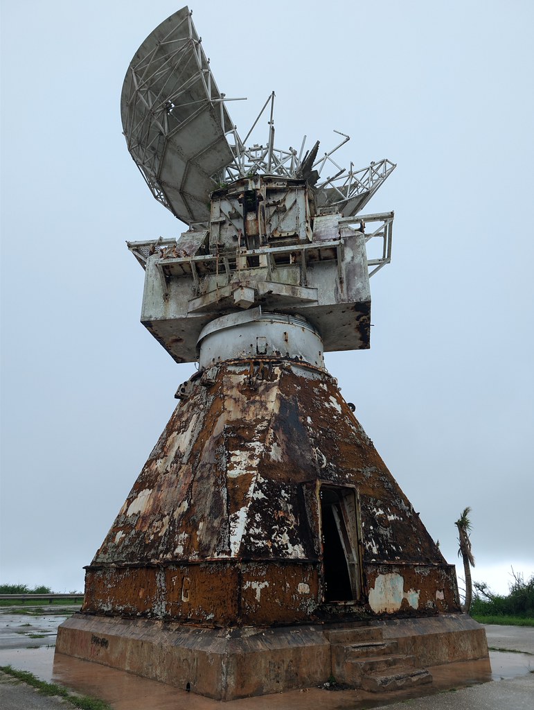
With that, our first day touring with Walt came to an end. We had covered a lot of ground and seen far more of Saipan than we ever could have managed on our own. We headed back to the hotel for the evening to get some rest, because the following morning Walt would be joining us again for the part of the trip I had especially been looking forward to—Tinian.
Part 6 - Finally, Tinian!
The following morning, it was finally time for Tinian. Located only a few miles southwest of Saipan, Tinian is a small, sparsely populated island of about 39 square miles, but its historical importance is far greater than its size would suggest. During World War II, the United States transformed much of the island into an enormous airbase, with North Field becoming one of the largest and busiest airfields in the world. From its runways, B-29 bombers flew missions against Japan, including, most famously, the flights carrying the atomic bombs to Hiroshima and Nagasaki.
What makes visiting Tinian particularly interesting today is that its military history is coming full circle. After being largely abandoned following the war, North Field is now being rehabilitated by the U.S. military so that it can once again support military aircraft — an increasingly important consideration as tensions with China have grown.
There had actually been some uncertainty as to whether we would make it to Tinian at all. A few months before our trip, Super Typhoon Sinlaku struck the Northern Mariana Islands, causing extensive damage on both Saipan and Tinian. Tinian was hit particularly hard, and as I followed the recovery efforts from home, I wasn't sure whether the island would be ready for visitors by the time we arrived. Fortunately, by the time of our trip, things had largely returned to normal, and our plans were able to go ahead as scheduled.
By complete coincidence, our visit to Tinian took place on August 6. We hadn't planned it that way, but exactly 81 years earlier, on August 6, 1945, the Enola Gay had taken off from North Field carrying Little Boy, the atomic bomb that would be dropped on Hiroshima later that morning. So, on the anniversary of that historic mission, we would be standing on the very airfield from which it began. The timing made an already fascinating visit even more interesting. We would be exploring one of the most historically significant airfields of World War II on the anniversary of its most famous mission, while at the same time seeing that same airfield being prepared for a new military role more than eight decades later.
Early that morning, Walt picked us up at our hotel and we headed to the airport. As part of our tour, he had arranged a charter flight on Star Marianas Air to take us over to Tinian. It is only a short hop from Saipan, but flying in a small plane across the channel made the journey considerably more interesting than the distance might suggest. Within minutes of taking off, Tinian was below us and our day exploring the island was about to begin.

Clockwise from top left: (i) Star Mariana Air poster; (ii) Star Marianas Air fleet; (iii) they don't accept cake as check in baggage anymore (must have been some major cake baggage incident); and (iv) landing at Tinian.

Upon our arrival, we were immediately greeted by a very tired looking welcome sign and World War II relics.

Our first stop of the day was the Japanese Radio Communications Building, a World War II-era structure that served as a communications center for the Japanese military before U.S. forces captured Tinian in 1944. Today, the abandoned building still stands and we were able to wander through its dark, deteriorating interior.

From there, we headed to what, for me, was one of the star attractions of Tinian: Runway Able at North Field. The history of the airfield actually predates the American invasion. The Japanese had constructed Ushi Point Airfield at the northern end of Tinian, and after U.S. forces captured the island in 1944, Navy Seabees immediately began repairing and dramatically expanding it.
More than eighty years later, North Field is once again being prepared for military use. During our visit, we could see heavy machinery repaving the old runways. Two of the four runways are scheduled for completion by 2027. We were able to walk out onto Runway Able, and I flew my drone over the airfield, which gave me an incredible aerial view and really drove home just how enormous the complex had once been.
As part of the current work, sections of the old pavement had been torn up, leaving large chunks piled alongside the runway. Naturally, I wasn't going to pass up an opportunity like that, so I collected a bunch of pieces to take home as souvenirs.
Apparently, our presence had also attracted some unwanted attention. While we were exploring North Field, we noticed that U.S. Marine security detail was following us and taking pictures of us. Eventually, we were approached by Master Sergeant M.T., who questioned us about who we were and what we were doing there. I explained that we were on a dream-of-a-lifetime trip and had come to explore Tinian's historic sites, and assured him that we weren't up to anything nefarious.
Once satisfied that we weren't rogue spies, M.T. relaxed a bit and told us that he was from Virginia and was part of the 513th Expeditionary RED HORSE Squadron. M.T. showed us his RED HORSE hat and I immediately offered to trade my bucket cap for it, but no deal. M.T. said the hat was hard earned and I'd have to find my own.

M.T. also told us about a civilian archaeologist working with the group who had earned the nickname “Two Stitch Timmy.” Apparently, Timmy wasn't the Indiana Jones type as he couldn't stand the sight of blood and fainted after cutting himself in the field one day—a rather unfortunate weakness for an archaeologist doing fieldwork.
The whole experience made our visit to North Field particularly memorable. Here we were, walking around this historic airfield on August 6—81 years to the day after the Enola Gay departed Tinian carrying the atomic bomb that would be dropped on Hiroshima—while heavy machinery worked around us preparing North Field for renewed U.S. military use. It was an extraordinary intersection of Tinian's past and present.
Clockwise from top left: (i) on the way to Runway Able; (ii) piece of original World War II pavement from Runway Able; and (iii) Runway Able undergoing resurfacing.

Clockwise from top left: (i) flying the drone from Runway Baker; and (ii) and (iii) aerial view of Runway Able.

We explored the Japanese World War II Air Operations Building, which served as the control center for the Japanese Navy’s 1st Air Fleet operations on Tinian, directing traffic on the runway to the south. It contained an office, the operations room, and a generator room.

We also explored the nearby Japanese World War II Air Raid Shelters.
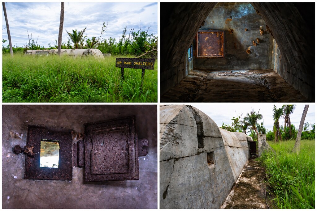
We then explored the Japanese Air Administration Building, a two-story structure that served during World War II as headquarters of the Japanese Navy’s 1st Air Fleet (Base Air Force of the Marianas).

From the Air Administration Building, we continued through the remains of the Japanese airfield complex to another piece of its wartime infrastructure: the old power plant.
Clockwise from top left: (i) exterior of the Power Plant; (ii) oil tanks; and (iii) and (iv) side exterior views.

From the Japanese power plant, we moved on to a site connected with a very different chapter of Tinian’s wartime history—and one that would ultimately give this tiny island an outsized place in world history: the atomic bomb pits. At Bomb Pit No. 1, Little Boy was loaded aboard the Enola Gay for the mission to Hiroshima; at Bomb Pit No. 2, Fat Man was loaded aboard Bockscar for the mission to Nagasaki.
Clockwise from top left: (i) Little Boy being loaded aboard the Enola Gay; (ii) the Enola Gay on Tinian; (iii) the mushroom cloud over Hiroshima; and (iv) the Enola Gay returning to Tinian after the bombing of Hiroshima.

Clockwise from top left: (i) sign leading to the atomic bomb pits; (ii) view of both Atomic Bomb Pit No. 1 and Atomic Bomb Pit No. 2 (also referred to as Loading Pits A and B); and (iii) close-up view of Atomic Bomb Pit No. 1.

Standing at the bomb pits on Tinian also brought home the continuing debate over the decision to use atomic bombs against Hiroshima and Nagasaki. With the benefit of hindsight, it is easy to question that decision, but I believe it has to be understood in the context of the war as it actually existed in the summer of 1945. Japan had fought with extraordinary tenacity throughout the Pacific, and the recent battles of Iwo Jima and Okinawa had demonstrated the staggering cost of taking even relatively small Japanese-held islands. On Okinawa alone, more than 12,000 Americans were killed, while Japanese military and civilian deaths were enormous. American planners preparing to invade the home islands knew that Japan was massing troops and preparing suicide aircraft and other weapons to resist the expected invasion.
For many of the Americans preparing to participate in that invasion, Japan’s surrender meant that an invasion they expected to be extraordinarily bloody never happened. Some veterans later described receiving news of Japan’s surrender as essentially learning that they were going to live. That sentiment has been passed down through American families by veterans who believed that, had the invasion gone forward, they might never have returned home—and that the children and grandchildren to whom they later told those stories might never have been born. The terrible human cost of Hiroshima and Nagasaki should not be minimized, but given the circumstances confronting American leaders in August 1945, I believe using the atomic bombs to bring the war to an end was the right decision.
From the bomb pits, we followed the story backward, driving over to the nearby Atomic Bomb Assembly Area, where Little Boy and Fat Man had been prepared before being brought to the pits for loading onto their B-29s. Today, only the concrete pad remains.

Having followed the story of Tinian almost to the end of the war, we next went back to where the American battle for the island began: Chulu Beach, one of the landing beaches used by U.S. forces during the invasion of Tinian.
Clockwise from top left: (i) view of Chulu Beach; (ii) live round found on the beach; and (iii) and (iv) Japanese WW II pillbox/bunker on Chulu Beach.

We passed by a U.S. landing craft disabled during the 1944 invasion of Tinian, reportedly after striking a Japanese mine.

Our next stop was the Seabees Monument, which commemorates the extraordinary work of the U.S. Navy construction battalions on Tinian. After the island was captured in 1944, thousands of Seabees descended on Tinian and transformed it into an enormous military base. They built and expanded airfields, roads, hospitals, camps, fuel and ammunition facilities, water and sanitation systems, and other infrastructure needed to support tens of thousands of American servicemen and hundreds of B-29s. By the time they were finished, Tinian had become home to what was then the largest airbase in the world.
One of the more whimsical aspects of this massive construction project was the Seabees’ decision to model Tinian’s road system after Manhattan. Tinian is roughly similar in size and shape to Manhattan Island, so the Seabees gave its new roads familiar New York names. Broadway and Eighth Avenue became the principal north-south roads, while other names included 42nd Street, 86th Street, Riverside Drive and Wall Street. They even designated areas of the island “Central Park,” “Harlem,” and “The Village.” Some of those New York street names survive on Tinian today.
The Seabees Monument includes a map showing this wartime “Manhattan” laid out across Tinian. The monument itself honors the 107th Naval Construction Battalion and the other Seabees who served on the island. Dedicated on November 11, 1985, its inscription commemorates their role in what it calls “the largest engineering feat of WWII” and remembers the Seabees who died.

After a day spent exploring Tinian’s World War II history, we made a stop at the beautiful Tachogna Beach on our way back to the airport. Just across the road was the Tinian Oceanview Hotel, a quirky little hotel made from shipping containers. Seeing it there made me wish we had more time on Tinian—I would have loved to spend a night and have a little more time to enjoy the beach before heading back to Saipan.

Continuing toward the airport, we stopped at the House of Taga Latte Stone Site, a remnant of Tinian’s pre-contact Chamorro past. The site once featured 12 enormous latte stones arranged in two rows of six. Today, only one remains standing, rising nearly 16 feet and believed to be the largest standing latte in the Mariana Islands.

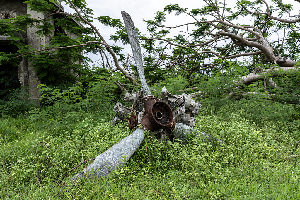
On Tinian, though, World War II history never seemed to be far away. Just a short distance from the House of Taga, we came across the remains of a Japanese Zero engine and three-bladed propeller.
Before returning the rental car, we had to fill up the tank—and if you think gas prices are high now, wait until you see the price of gas on Tinian.

With the rental car fueled and returned, our day on Tinian had come to an end. We headed into the tiny airport to check in for our short flight back to Saipan. Once airborne, our pilot, Kang, graciously circled Tinian’s airfields so we could take some aerial photos before heading back to Saipan.

With that, our time exploring Saipan and Tinian had come to an end. Over the past several days, we had seen an incredible amount of World War II history, much of it still remarkably visible more than 80 years later. Now it was time to leave the Mariana Islands behind and prepare for the next leg of our journey. Our next destination was Palau—and one of the places that had inspired this entire trip in the first place: Jellyfish Lake.
Part 7 - Back to Guam: The Long Way to Palau
Before we could get to Palau, we first had to go back to Guam. Our flight from Saipan arrived in the morning, while our flight to Palau wasn’t scheduled to depart until late that night. That left us with an entire day on Guam—and there was no way we were going to spend it sitting at the airport.
I was particularly proud of what I managed to pull off with our long layover. I booked a room at the Dusit Thani Guam Resort for $339.66 using the $300 hotel credit from my American Express Platinum Card, bringing our out-of-pocket cost down to just $39.66. Even better, the stay included a $100 food or spa credit, which Oldest Kid put toward a massage. Meanwhile, we had a comfortable place to leave our things and could spend the day enjoying the resort, including its pool and beach. It was a considerably better way to spend a long layover than sitting in an airport terminal. The Dusit Thani is perhaps the nicest resort on Guam, and if you don’t need a kitchen, it’s an excellent choice.
Information about the Dusit Thani can be found here.
Photos of our room and the beach.

After a full day of R&R, it was time to pack up and head back to the airport for the next leg of our journey: Palau.
Part 8 – Palau: Jewel of Micronesia — The Rock Islands and Jellyfish Lake
There are very few destinations I have found so stunning, so exceptional, that I would tell someone simply: find a way to get there. Palau is one of them. Jellyfish Lake was what originally drew me to Palau and, before the trip, it was the experience I was most looking forward to. But once we arrived, Jellyfish Lake quickly became just one part of what made Palau so extraordinary. Between the Rock Islands, incredible marine life, pristine waters, and remarkable World War II history still hidden throughout the islands, there was far more to Palau than I had ever anticipated. If Palau isn’t already on your bucket list, I strongly suggest moving it near the top.
Our flight from Guam to Palau was uneventful and relatively short, at just over two hours. This time, United upgraded me to first class automatically, without even asking whether I wanted the upgrade—and DW was not particularly pleased. I offered her my first-class seat, but she told me to just take it and go. I decided it was probably best not to argue.

We arrived in Palau late Sunday night, giving us just three full days to explore before continuing on to Japan the following Thursday. For our stay, we booked the Executive Suite at the Palau Central Hotel, which gave us two bedrooms, a living room, and a full kitchen for about $373 per night, including breakfast. Airport transfers were available for an additional $25 each way.
As for breakfast, when I went to check it out the following morning, I was surprised to see bagels. Figuring they were probably kosher, I asked to see the bag they came in, and sure enough, they had an OU. Each morning, I asked for a bag of bagels and picked up individual packets of butter, peanut butter, and Nutella to make sandwiches for the day. I added some tinned fish to mine, which made for a filling breakfast/lunch while we were out exploring. The local supermarkets also carried a surprisingly wide variety of kosher products imported from the U.S.
Kosher bagels at breakfast.

Although Palau has several beautiful resorts, the Palau Central Hotel was a much better fit for us for two important reasons. First, its downtown location put us within walking distance of several supermarkets. Second—and even more importantly—the Executive Suite had a full kitchen with a full-size refrigerator. For us, those practical advantages outweighed staying at one of Palau’s more traditional beachfront resorts. If you find yourself in Palau, I highly recommend the Palau Central Hotel.
Information about the Palau Central Hotel can be found here.
Clockwise from top left: (i) front entrance to the hotel; (ii) pool area behind the hotel; (iii) one of our two bedrooms; (iv) bathroom; and (v) the second bedroom.

For our first full day in Palau, we booked a private Rock Islands tour with Sam’s Tours. The private tour cost only a few hundred dollars more than joining a group, and gave us the flexibility to shape the day around exactly what we wanted to see and do. The full-day excursion took us by boat through Palau’s spectacular Rock Islands, with stops for snorkeling and visits to some of the area’s best-known attractions, including the Milky Way and, most importantly for us, Jellyfish Lake. An added benefit of having the boat to ourselves was that we often arrived at stops when no one else was there, making it feel as though we had our own little piece of paradise.
Sam’s Tours is one of the best-known tour operators in Palau, and, like many visitors, I went with the popular choice. In retrospect, however, I would have chosen a different operator. I’ll explain why—and who I would recommend instead—a little later.
Information about Sam’s Tours can be found here:
Our first stop of the day was the Milky Way, a secluded lagoon tucked among Palau’s Rock Islands. The lagoon is famous for the soft white limestone mud that collects on its bottom, giving the surrounding water its distinctive pale turquoise color. Visitors scoop up the mineral-rich mud and smear it over themselves like a natural spa treatment before washing it off in the lagoon. Naturally, we had to give it a try.
And yes, the water is really that dreamy aquamarine color.


After leaving the Milky Way, we stopped at several snorkeling spots before making our way to the attraction I had been looking forward to: the world-famous Jellyfish Lake. Although I can’t say we encountered the thousands upon thousands of jellyfish sometimes pictured in photographs of the lake, we were told that the jellyfish population was the best it had been in years. And there were certainly enough of them to make swimming among these remarkable creatures an experience unlike anything we had ever done before.
Jellyfish Lake is one of Palau’s most famous natural wonders—and one of the places that had originally inspired us to make this trip. Hidden within the Rock Islands, the marine lake was once connected more directly to the surrounding ocean but became increasingly isolated over thousands of years. Today, it is home to two species of jellyfish: the famous Golden Jellyfish, as well as Moon Jellyfish. With relatively few predators in the lake, the Golden Jellyfish have evolved greatly reduced stinging ability compared with many of their ocean-dwelling relatives, making it possible for visitors to swim and snorkel among them. The surreal experience of floating through green water surrounded by jellyfish has made the lake one of Palau’s most iconic attractions.
Reaching Jellyfish Lake required a short hike from the boat dock, climbing up and over the rocky ridge that separates the marine lake from the surrounding lagoon.

Clockwise from top left: (i) through (iii) Golden Jellyfish; and (iv) Moon Jellyfish.

After leaving Jellyfish Lake, we continued exploring the Rock Islands, stopping at another reef for some more snorkeling. The kids summed it up best: “There is simply no point snorkeling anywhere else after this.” The difference between Palau and anywhere else we had snorkeled was that striking.


Our final snorkeling stop of the day brought us back to Palau’s World War II history, as we explored the remains of a Japanese shipwreck.

On the way back, we passed several more remnants of the Japanese presence in Palau during World War II. Clockwise from top left: (i) and (ii) a seaside cave used by the Japanese as a refueling station, with fuel barrels still sitting inside the cave; (iii) a Japanese pillbox; and (iv) a Japanese gun.

After an incredible first day exploring the Rock Islands and finally getting to experience Jellyfish Lake, we returned to our hotel for the night. Another very different kind of adventure awaited us the following morning.
Part 9 – Ngesebus: A Battlefield Where History Still Lives
The following morning, we set out for a very different kind of adventure. This time, we joined Paddling Palau for a private tour to Ngesebus or Ngedebus (pronounced “Ne-da-bus”), where our focus would shift from Palau’s natural wonders to its remarkable World War II history—although, as we would soon discover, there would be plenty of spectacular scenery along the way. After spending much of our first day swimming and snorkeling, it was nice to spend our second day largely on dry land—especially since our third and final day in Palau would have us heading right back into the water.
While our tour with Sam’s Tours the previous day had been perfectly fine, our experience with Paddling Palau was exemplary. The difference was significant enough that, if I were planning the trip again, Paddling Palau would be my first choice. I cannot recommend them highly enough.
Information about Paddling Palau can be found here:
Ngesebus may be a small and peaceful island today, but in September 1944 it became part of the brutal Battle of Peleliu. Located just north of Peleliu, the island was occupied by Japanese forces who had constructed defensive positions and were developing an airfield there. On September 28, 1944, the 3rd Battalion, 5th Marines launched an amphibious assault on Ngesebus, securing the island the following day.
One of the Marines who fought on Ngesebus was Eugene B. Sledge, who later recounted his experiences on Peleliu, Ngesebus, and Okinawa in With the Old Breed: At Peleliu and Okinawa, one of the best-known firsthand memoirs of the Pacific War. Having read Sledge’s account made visiting Ngesebus particularly fascinating: we were exploring the same tiny island where Sledge and his fellow Marines had fought more than 80 years earlier.
In Chapter 5, “Another Amphibious Assault,” Sledge describes the fighting on Ngesebus, including a memorable encounter with a Japanese pillbox the Marines had been told was empty. When Sledge looked over the position, he unexpectedly found himself face-to-face with a Japanese machine gunner inside.
More than 80 years later, the jungle has reclaimed much of Ngesebus, but remnants of the battle are still remarkably visible. Japanese bunkers, pillboxes, guns, and other wartime remains are scattered throughout the vegetation.
But first, we had to get to Ngesebus. Our journey began with a boat ride to Peleliu, where we switched to kayaks for the final stretch to Ngesebus.
Clockwise from top left: (i) kayaking over to Ngesebus; (ii) playing with crabs on the beach; (iii) live World War II round found on the beach; and (iv) storing the kayaks.

Before we began exploring Ngesebus, I should introduce our guide, Ron Leidich, the owner of Paddling Palau. It is rare that I meet someone whose accomplishments I find so impressive. Ron is a biologist, wilderness guide, dive instructor, and expedition leader who has spent decades exploring Palau and the surrounding region. He also leads National Geographic expeditions to some of the most remote places in the world. His knowledge of the natural world was extraordinary, and he was simply an incredibly impressive person—the kind of person who makes you start reconsidering the significance of your own rather meager list of accomplishments. He may very well have been the best guide we have ever had.
Ron giving us an orientation to Ngesebus before we set out to explore the island.

After our orientation, we set off into the jungle to begin exploring. Although there were what appeared to be trails in some places, much of our exploration involved bushwhacking through thick jungle, with our guides using machetes to clear a path as we went. It definitely wasn't your typical guided historical tour—which, of course, made it that much more fun.
It wasn't long before we came across the first of the many World War II remnants scattered across Ngesebus: a Japanese Model 10 120 mm dual-purpose anti-aircraft and coastal-defense gun, still sitting in its wartime emplacement more than 80 years later.

We also came across remnants of a narrow-gauge rail system used by the Japanese on Ngesebus. The Japanese were in the process of constructing an auxiliary airfield on the island when the Marines landed in September 1944, and sections of the old rail line can still be found disappearing into the jungle today.

A very unhappy land crab. Land crabs were a notorious nuisance to the Marines in the Pacific. Sledge recalled killing over a hundred of them from his tent alone while on Pavuvu. W. Henry Sledge, The Old Breed: The Complete Story Revealed (2025), p. 25.

Ngesebus was also home to a Japanese airfield during the war. Although the airfield itself has long since been reclaimed by the jungle, remnants of Japanese aircraft are still scattered throughout the island, including pieces of wreckage and propellers slowly being swallowed by the vegetation. Here is the propeller of a crashed Japanese Zero.
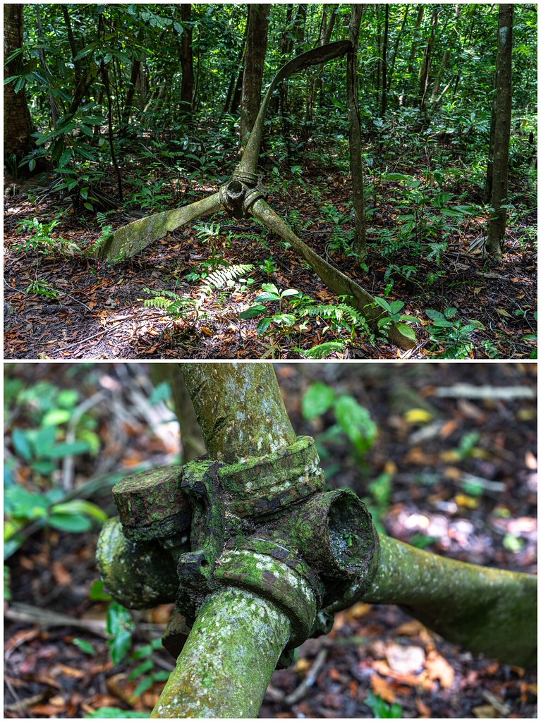
We continued bushwhacking our way through the jungle until we finally reached one of the sites I had particularly wanted to see on Ngesebus: the Japanese bunker described by Eugene Sledge in With the Old Breed. Having read Sledge’s firsthand account of the fighting here, there was something extraordinary about emerging from the jungle and seeing the actual bunker still standing more than 80 years later.
Sledge describes approaching the bunker after the Marines had been told that it was empty. When he looked over the position, however, he unexpectedly found himself face-to-face with a Japanese machine gunner inside. He later described the encounter in With the Old Breed.
The Marines had been told that the bunker had already been cleared, but as Sledge and the rest of his mortar section began setting up nearby, they heard Japanese soldiers talking inside. What followed was a fierce fight at extraordinarily close range. Sledge himself narrowly escaped being killed when he looked over the bunker wall and found himself staring directly into the muzzle of a Japanese machine gun only a few feet away. He ducked just as the gunner fired over his head.
The Marines dropped grenades through a ventilation opening, only to have the Japanese soldiers throw grenades back out. Several Japanese soldiers who attempted to escape were shot, but those remaining inside continued to resist. Eventually, an amtrac armed with a 75 mm gun was brought forward and fired three rounds into the bunker. Even that failed to end the resistance, and a flamethrower was ultimately needed to clear the position. When it was over, 17 Japanese soldiers were found dead in and around the bunker.
More than 80 years later, that bunker is still there.

Near the bunker, we found these rusting cylinders, which appear to be remnants of World War II flamethrower equipment. Sledge identifies Cpl. Charles Womack as the Marine who used a flamethrower to finally clear the bunker. Given where these cylinders were found, they could very well be the tanks from the flamethrower Womack used to clear this very bunker more than 80 years ago.

There is still plenty of live ordnance lying around Ngesebus.

And it wasn't only ammunition. Remnants of Japanese military equipment were scattered throughout the jungle, slowly rusting away where they had been left after the end of World War II. In some places, the forest floor seemed almost littered with pieces of the war. Ron's son, Calvin, who joined us on the tour, was saddened by how much some of the guns had deteriorated. I'm not sure exactly when he had last seen them, but he remembered them being in much better condition.

At this point, we returned to the beach where we had left the kayaks for a break and some cold drinks. While we all enjoyed some fresh coconut, Little One and Calvin held hermit crab races. Little One won every race, having apparently developed quite a talent for selecting the fastest hermit crab.


After our break, we left the beach behind and headed back into the jungle. More bushwhacking eventually brought us to another Japanese bunker, its concrete walls increasingly obscured by the dense tropical vegetation. It looked as though the jungle was slowly swallowing it whole, with a large tree actually taking root on top of the structure.

We later came across another bunker that had been almost completely reclaimed by the jungle. From a distance, you could barely tell that a bunker was there at all; it was only when we got closer that the structure became apparent beneath the vegetation.

Exploring the inside of one of the Japanese bunkers, where remnants of the fighting still remain.

A Japanese World War II canteen found inside the bunker.

One of the most remarkable relics we encountered was this American M4 Sherman tank. The tank struck a mine during the fighting on Ngesebus and was disabled, but its gun remained operational. Rather than abandon it, the Marines piled coral around the immobilized tank and continued to use it as a stationary gun emplacement. The coral still surrounds the hull today, while the turret and 75 mm gun remain remarkably intact. And, of course, all of the kids took turns climbing inside the tank.

The Sherman tank was our final stop on Ngesebus. From there, we returned to our kayaks and paddled back to where our boat was waiting. Ngesebus had been an extraordinary experience, particularly after reading Sledge’s account of the fighting there. But our Palau adventures weren't over yet. The following day would bring something completely different—including snorkeling out to a Japanese Zero resting on the reef.
Part 10 – Risong Bay: Beneath the Waters of Palau
For our third and final full day in Palau, we headed back onto—and into—the water. After spending our first day exploring the Rock Islands and Jellyfish Lake and our second bushwhacking through the World War II history of Ngesebus, our final day would combine some of the best of both: Palau’s extraordinary natural beauty and its wartime history. We would spend the day exploring Risong Bay, snorkeling among spectacular coral reefs and marine life, and, most excitingly, swimming out to the wreckage of a Japanese Zero that had been resting on the reef since World War II.
We didn't have to wait long for the highlight. Our first stop of the morning was the Japanese Zero. Our captain, Jefferson, had an extraordinary personal connection to this particular wreck: he had actually met its pilot.
Jefferson was a native Palauan from one of the outer islands, and throughout the day I enjoyed talking with him about Palau during World War II. I was particularly interested in hearing about the war from the perspective of Palauans themselves—people whose islands became battlefields in a war between two foreign powers. He shared a number of stories he had heard from Palauans who had actually lived through the war.
The pilot of the Zero had survived the war and returned to Palau many years later. While out on a tour with Jefferson, he began giving him directions, eventually pointing toward a particular spot on the reef. As they approached the wreckage, he simply said, “That is my plane.”
He told Jefferson that he had been involved in a dogfight over Koror and, rather than go down in deep water, deliberately crashed his damaged aircraft onto the shallow reef so that he could get out and walk back to base. Jefferson remembered him as a rather mean old Japanese man with “the heart of a samurai.”
Pictures of the crashed Zero.

As we continued through Risong Bay, I took the opportunity to ask Jefferson more about what he had heard from Palauans who lived through the war. Several of his stories stuck with me. Jefferson recalled the 70th-anniversary commemoration of World War II in Palau, at which both American and Japanese veterans returned to the islands. He remembered the former enemies sitting opposite one another and said that, from the looks on their faces, they appeared as though they still wanted to kill each other.
Another story that stuck with me was about one of Jefferson’s uncles. During the war, his uncle was hiding in a cave with another relative when they saw a small American boat approaching. The relative went out to take a look and was shot in the head. When the Americans then threw a grenade into the cave, Jefferson’s uncle escaped through an opening in the back. The grenade left a series of scars across his back, which he later took great pride in showing off as proof of just how tough he was.
Jefferson also told us that when the bombing of Palau began, some Palauans living on the outer islands had no idea what the shiny objects falling from the sky were. At first, they thought they might be gifts of canned tuna. In one particularly tragic example, a Palauan found an unexploded munition and decided to turn it into a cooking pot. When he tried to cut it open, it exploded.
In another story, one of Jefferson’s relatives had taken shelter in a dugout covered with coconut leaves during a bombing raid. When he emerged afterward, he discovered an enormous unexploded bomb lying just outside the shelter.
Jefferson also talked about the lasting trauma experienced by the generation that had lived through the war. For years afterward, the sound or sight of an airplane overhead could send some of them frantically running for cover. As children, Jefferson and his friends would laugh at them, not understanding why they reacted that way. It was only when Jefferson got older and came to understand what they had lived through that he realized those reactions were rooted in the trauma of the war—and came to regret having made fun of them.
Interestingly, Jefferson described a striking generational divide in attitudes toward the Japanese. Some of the older Palauans who lived through the war still harbor deep resentment because of the cruelty they experienced under Japanese rule. Among younger generations, however, those feelings have faded considerably. Jefferson himself married a Japanese woman. When I asked how they met, he explained that she had come to Palau as a tourist and, as he put it, “you know, stuff happens on the water.”
Other members of Jefferson’s family have also married Japanese, much to the displeasure of his grandfather, who is still alive at 100 years old and remembers the war. Jefferson said that when he visits him, his grandfather still curses the Japanese.
While I could have listened to Jefferson’s stories all day, there was still plenty more of Risong Bay to explore. Our next stop was an incredible protected coral reef. We had just been admiring the coral growing over the remains of a World War II ship; now we were snorkeling through a reef where the coral itself was the main attraction.

Eventually, our final day in Palau had to come to an end. Between kayaking through Risong Bay, snorkeling spectacular reefs, and hearing Jefferson’s stories about Palau during the war, it had been another extraordinary day—and a fitting end to our time in Palau.
Three full days in Palau had seemed like plenty when I planned the trip. By the time we left, it didn't seem like nearly enough. Leaving Palau meant that our island-hopping adventure across the Pacific was nearing its end—but the trip itself wasn't over quite yet. One final destination remained: Japan.
Part 11 – Tokyo: The Final Chapter Begins
Not wanting to spend a third Shabbos on our own, we planned our departure from Palau so that we would arrive in Tokyo on Thursday afternoon, with plenty of time to settle in before Shabbos. That morning, we checked out of the Palau Central Hotel and took the hotel shuttle to the airport for our flight to Tokyo.

Once again, I was involuntarily upgraded to first class, albeit only to a wider recliner seat rather than lie-flat. Still, with a flight time of about four hours, the extra space was very welcome. DW didn't seem particularly bothered by this upgrade, and since the flight wasn't full, the rest of the family was able to spread out in the back.
As it turned out, our timing was extremely fortunate. We landed in Tokyo just one day before record rainfall hit the area, stranding thousands of travelers at Narita Airport and causing widespread flooding and transportation disruptions. More than 14 inches of rain fell in 24 hours in parts of Chiba Prefecture surrounding Narita, knocking out power to thousands of homes and leaving roads and railways flooded. Once again, we felt the yad Hashem protecting us throughout our travels. Our itinerary was relatively tight, and a major disruption at any point could easily have thrown the remainder of the trip into disarray.
Our plan was to spend six nights in Tokyo, followed by five nights in Kyoto, before returning to Tokyo for one final night prior to our flight home. We split our Tokyo stay between two accommodations.
For our first few nights, we stayed at Chabad of Tokyo’s Shabbos-friendly apartment rental, which was set up with three bedrooms by converting the “Japanese” room into an additional bedroom. The location couldn't have been more convenient—it was only about a 30-second walk from the Chabad House. Calling it an “apartment,” however, is a bit of a misnomer. It was actually a traditional-style Japanese house tucked away along a narrow alleyway, which made the stay itself an interesting introduction to Tokyo. When we arrived, there was no one there to meet us, and finding the house proved a bit of a challenge. We initially had no idea where it was, but our taxi driver went into the narrow alleyway to search for it. Armed with a photo of the entrance that the Rebbetzin had sent us, he eventually found the house and led us to our home for the next few nights.
More information about the Tokyo Chabad apartment rental, including photos, can be found here.
Information about the Official Tokyo Chabad can be found here.
After settling in, it probably isn't hard to guess where we went next—David's Deli. We hadn't had a restaurant-quality meal in several weeks, and we were very much looking forward to trying some traditional Japanese dishes. When we were last in Tokyo in 2023, Chabad operated Chana's Place Restaurant out of the Chabad building. Since then, Chana's Place had closed and been replaced by David's Deli.
Information about David's Deli can be found here.
A sampling of the dishes we tried during our stay in Tokyo, clockwise from top left: (i) Beef Ramen; (ii) Burger and fries; (iii) Yakisoba; (iv) Steam Momo; and (v) Loco Moco.
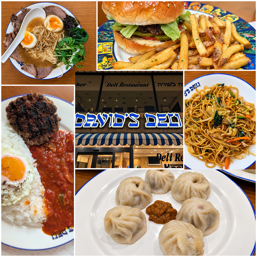
Shabbos at Chabad was an interesting mix, as it usually is. Mealtimes were packed with Jews from all over the world, making for quite an eclectic crowd. Fortunately for us, the particularly loud and talkative group of Israelis ended up at another table. We kept mostly to ourselves at our corner table and “enjoyed” the ruckus from the neighboring table.
On Sunday, we moved over to the Andaz, our favorite hotel in Tokyo, where we booked two rooms with Hyatt points. Now, I’m certainly not claiming to be a connoisseur of Tokyo hotels—we’ve only stayed at three different ones so far, including on this trip. But there are several reasons we love the Andaz, some of which admittedly may not be selling points for everyone: (i) the service is exemplary; (ii) it’s located in a quiet business district; (iii) the hotel never feels crowded; (iv) the spa is usually nearly empty; and (v) we get unlimited complimentary soft drinks, coffee, and tea.
Information about the Andaz Tokyo can be found here.
Our stay in Tokyo wasn't particularly structured. Although we had a few places we wanted to visit, we mostly spent our time wandering around the city and shopping for clothes, trinkets, and souvenirs.
One of our first orders of business, however, was tracking down the banana vending machine in Shibuya Station. It took us a while to find it, but eventually we did—and, of course, everyone had to try an overpriced vending-machine banana.

And, of course, we had to return to Hands Department Store in Shibuya for another freshly squeezed orange juice from the vending machine.

Later in the trip, Little One saw workers in Kyoto wearing air-conditioned jackets and decided he wanted one. So, when we returned to Tokyo for one night before our flight home, we headed to Ikebukuro to buy one—and came across an apple juice vending machine. Naturally, we all had to try that, too!

But back to our day in Shibuya: no visit is complete without the obligatory stop at Shibuya Scramble Crossing.

We were also looking forward to having some delicious Japanese peaches. Conveniently, there is a supermarket right near Chabad, where we were able to indulge our cravings. They certainly weren't cheap, but they were well worth the splurge.

We spent some time exploring Ginza, one of Tokyo’s best-known shopping districts. With the main shopping avenue closed to traffic, we were able to wander down the middle of the street, browsing the shops and taking in the neighborhood along the way. Far from putting a damper on the afternoon, the rain provided a welcome reprieve from Tokyo’s summer heat.

While in Ginza, we also made our way to Itoya, the famous Japanese stationery store. With floor after floor of pens, paper, notebooks, art supplies, and all sorts of things we didn't know we needed until we saw them, it was an easy place to spend far more time than we had intended.
Information about Itoya can be found here.

We also spent some time exploring Asakusa, one of Tokyo’s historic districts, wandering through its lively shopping streets filled with everything from traditional Japanese goods and souvenirs.

But shopping wasn't the only reason we had come to Asakusa. We had also booked a kintsugi class at ZEN Japanese Craft Studio, where we would get the chance to try our hand at a traditional Japanese craft. Kintsugi is the art of repairing broken pottery. Rather than trying to disguise the cracks, kintsugi highlights them, traditionally using lacquer and powdered gold to transform the repaired areas into part of the piece’s design.
Information about ZEN Japanese Craft Studio can be found here.
The origin of kintsugi is unknown. A popular story tells of the technique’s development in the late 15th century when shogun Ashikaga Yoshimasa’s favorite Chinese tea bowl was broken. According to the story, he sent the bowl to China to be repaired. When it returned, it was mended with staples, a practice in which metal is inserted into drilled holes on either side of the break to keep the pieces together. Yoshimasa disliked the appearance and had Japanese craftspeople come up with a new method that was more aesthetically pleasing, hence the beginnings of kintsugi.
During the class, each of us worked on our own piece of broken pottery, learning the process of joining the pieces back together and highlighting the repaired seams in gold. It was a fun, hands-on way to experience a traditional Japanese craft, and we each came away with a unique souvenir that we had made ourselves.
Our handiwork.

While at ZEN Japanese Craft Studio, I visited the restroom and discovered the real reason Japan lost World War II: Japanese men couldn't aim.

After finishing our kintsugi class, we continued exploring Tokyo and made our way to Ueno Park. There, we came across Shinobazu Pond, which at that time of year was almost completely covered in lotus plants. The sheer number of them was incredible, with pink flowers scattered among an enormous sea of green leaves, all set against the Tokyo skyline.

We weren’t quite saying goodbye to Tokyo—we’d be back for one more night before flying home. But for now, it was time to move on to our next stop in Japan: Kyoto.
Part 12 - Kyoto: A Little History, a Little Wonder, and a Little Whisky
When we were last in Japan in 2023, a typhoon foiled our plans to visit Kyoto. This time, we finally made it—though the weather presented a different challenge!
We traveled from Tokyo to Kyoto by Shinkansen. For some reason, I hadn’t been able to book the tickets online before our trip, so we took care of it at Narita Airport when we arrived in Japan. We reserved luggage seats at the rear of the car (at no extra charge), with space for our large suitcases directly behind the seats. That space was reserved for passengers who had booked those seats, rather than being available to everyone in the car.
Rather than use a luggage-forwarding service, we preferred to take only what we needed for Kyoto with us. We left the rest of our luggage at the Andaz, where they held it until we returned for our final night in Tokyo before flying home.
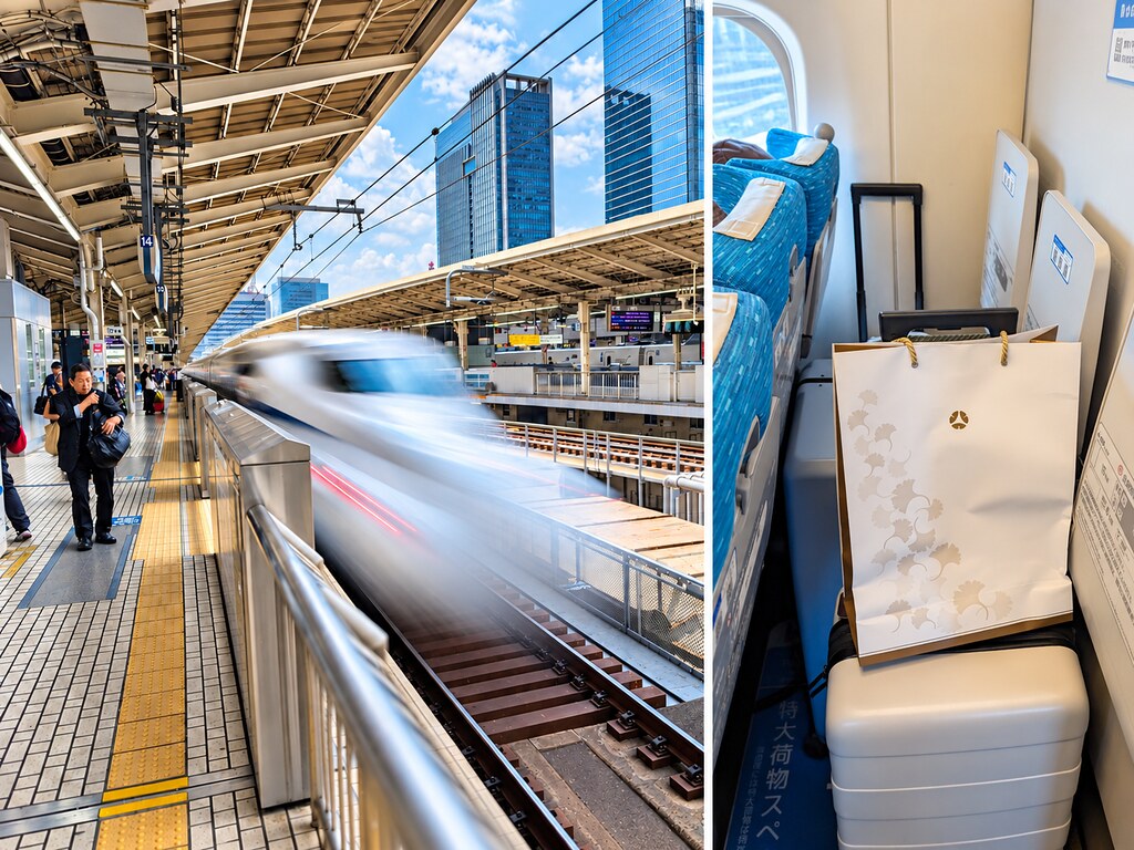
For our five nights in Kyoto, we stayed at the Hotel Okura Kyoto Okazaki Bettei, a luxury property directly across the street from Chabad. We booked two rooms, one at approximately $235 per night and the other at $209. The location turned out to be an excellent choice. While the weather in Tokyo had ranged from cool and rainy to tolerable, Kyoto was oppressively hot, and we were grateful for the short walk to Chabad. There were other conveniences nearby, too: a supermarket directly across the street, a Lawson convenience store a few blocks away, and a self-service laundromat just one block away.
The service was exemplary. The staff were attentive throughout our stay and especially gracious about helping us on Shabbos. Before we left, I bought gift boxes of fruit for the staff as a thank-you for taking such good care of us. I would not hesitate to recommend the hotel and would gladly return for another stay.
More information about the hotel can be found here:
Photos of the hotel and our rooms.

Having Chabad directly across the street was extremely convenient, particularly for Shabbos, although our experience there was not nearly as positive as the one we had had with Chabad Tokyo. The shul was very small, and the “two scoops” was simply too much for me. Shabbos meals were served in a crowded tent rather than indoors. Fortunately, they ran out of space in the tent on Friday night, so we were able to eat inside. But if you want to stay in Kyoto for Shabbos, they are the only game in town. In addition to Shabbos meals, we also ordered weekday meals, and although the selection was not as diverse as in Tokyo, it was sufficient to keep us fed during our stay in Kyoto. Just keep in mind that the Chabad rabbi requests that weekday meals be ordered three days in advance.
Information about the Kyoto Chabad can be found here.
The following morning, we were up at around 5 a.m., determined to reach the Arashiyama Bamboo Grove before the crowds arrived and the midday heat set in. Located on the western side of Kyoto, this famous grove has walking paths lined with towering bamboo, creating a leafy green canopy overhead. It’s one of Kyoto’s best-known sights, but our early start paid off: when we first arrived, we had the grove almost entirely to ourselves. A sign warning of bears in the early morning and at night suggested that other tourists weren’t the only company we might have had. Fortunately, no bears made an appearance.
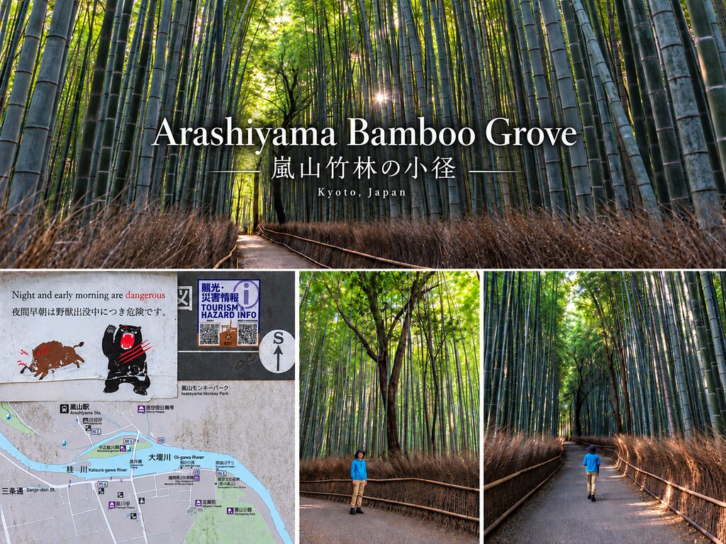
After exploring the bamboo grove, we paused to rest before stopping at 7-Eleven for cups of ice and orange juice—a refreshing way to cool off in the heat. We then continued on foot to Arashiyama Monkey Park Iwatayama, which opened at 9 a.m. Set on a hillside overlooking Kyoto, the park is home to wild Japanese macaques that roam freely rather than being kept in cages. Reaching the main viewing area involves a somewhat strenuous uphill walk, especially in the summer heat. Once at the top, visitors can watch the monkeys and enjoy sweeping views across the city. There’s also a feeding hut with a fun twist: the people go inside, while the monkeys stay outside, reaching through the wire mesh for food purchased at the park.
Admission was cash-only when we visited and cost ¥800 per adult. Be sure to bring a little extra cash to buy food for the monkeys.
Information about Arashiyama Monkey Park Iwatayama can be found here.
Clockwise from top left: (i) entrance to the park; (ii) feeding the monkeys; and (iii) through (v) monkeys at the park.

For our next outing, we split up: DW and the kids headed to teamLab, while I set off on my own to visit the Yamazaki Distillery, where visitors had to be at least 20 years old. I wouldn’t claim to have a particularly sophisticated palate, but I’ve developed an appreciation for Yamazaki since being served a complimentary glass on our JAL flight during our previous trip to Japan. Apparently, my palate just needed the right introduction.
Visits required advance reservations, but despite checking the website on several occasions, I couldn’t figure out how to enter the lottery for a tour of the distillery itself. The only option I could find was a free museum visit, which also included access to the tasting room. I booked that, figuring that even without the full distillery tour, it was worth making the trek while I was in Kyoto.
I was still hoping I might be able to talk my way onto a distillery tour once I arrived, but no such luck—I was told the tour had already ended. I checked the website again afterward, but the distillery tour was then listed as unavailable. For this visit, I would have to settle for the museum and tasting room.
Information about the Yamazaki Distillery can be found here.
Getting to the distillery from our hotel meant taking a bus and several trains, but with the help of Google Maps, I managed to find my way. From the aptly named Yamazaki Station, it was about a ten-minute walk to the distillery, with a railway crossing along the way. For reasons that should be self-evident, crossing those same tracks proved considerably more challenging on the return trip to Kyoto.

I first explored the museum, which I found a bit underwhelming. I suppose there is only so much enthusiasm one can muster for an impressive collection of rare and historic whisky bottles when they remain tantalizingly inaccessible behind glass.

Afterwards, I made my way over to the tasting room. I wasn’t entirely sure whether I wanted to spend the money on tastings, but ultimately decided that, while I was there, I might as well go for it. I tried the 18-year-old Yamazaki and the 21-year-old Hibiki. While I found the Hibiki downright unpleasant, my decidedly unsophisticated palate couldn’t discern much difference between the 18-year-old Yamazaki and the 12-year-old version I typically buy when I have a kiddush. I briefly contemplated trying a third, but then decided that if I had any hope of finding my way back to the hotel on my own, stopping at two was probably the wiser choice.

And then it was time to head back. I tried to walk as straight as I could and successfully made it to Yamazaki Station. I was a bit wobbly by the time I boarded the train, and with my Yamazaki souvenir bag in hand, the locals probably had a pretty good idea of what I’d been up to. Still, I managed to navigate my way back to the hotel in one piece. Mission accomplished.
In the meantime, DW and the kids were enjoying teamLab Biovortex Kyoto, which had opened less than a year before our visit. teamLab is difficult to describe as a traditional art museum, since much of the experience involves actually stepping into the artwork. Rooms are transformed by constantly changing displays of light, color, sound, and movement, with many of the installations reacting to the people around them. With more than 50 exhibits spread throughout the enormous space, there was certainly plenty for them to explore while I was off at Yamazaki. That said, despite how impressive some of the exhibits looked in photos, they all came away feeling that the experience was pretty skippable and not nearly as exciting as they had expected.
Information about teamLab Biovortex Kyoto can be found here.
The photos they brought back do a much better job of conveying the experience than I ever could:

The following day, we turned our attention to a very different side of Kyoto with an English-language tour of the Kyoto Imperial Palace. For centuries, Kyoto was Japan’s imperial capital, and the palace served as the residence of the Imperial Family until the capital moved to Tokyo in 1869. The present palace complex dates largely from the 19th century and preserves the traditional architectural style of the imperial court. Set within the expansive grounds of Kyoto Gyoen National Garden, the palace provides an interesting glimpse into Japan’s imperial history and the world in which its emperors once lived.
Information about the Kyoto Imperial Palace can be found here:
The only English-language tour offered that day was at 10:00 a.m., by which point it was already brutally hot outside. The tour was free, but unfortunately the entire tour took place outdoors, since visitors were not permitted to enter any of the palace buildings. Our guide was very conscious of the heat and pointed out every patch of shade along the route, directing the group to wait there whenever possible. Toward the end of the tour, we spent some time in the air-conditioned visitor room, where there were also fans, cooling off before heading back outside.
Clockwise from top left: (i) Kenreimon Gate, the main southern gate of the Kyoto Imperial Palace. Also known as the South Gate, it was the formal gate used by the emperor for important ceremonial arrivals and departures. Its roof is covered with cypress bark, and the gate features elaborate carved and gilded decorations; (ii) Ogakumonjō, usually translated as the Palace for Study and Other Ceremonies, or simply the Study Hall. In December 1867, the proclamation restoring imperial rule was issued here in the presence of the young Emperor Meiji; (iii) Shunkōden, built in 1915 for the enthronement of Emperor Taishō; (iv) Nikkamon Gate, the eastern gate leading into the Shishinden ceremonial courtyard; and (v) Gonaitei, the private garden beside the emperor’s residential quarters.

After our tour of the Imperial Palace, DW and some of the kids were ready for something a little more hands-on — and, just as importantly, something indoors and out of the heat. They had wanted to visit the Samurai Ninja Museum Kyoto and take part in its samurai experience. I decided to sit this one out, as it struck me as a bit kitschy, but they were interested in giving it a try. The samurai were Japan’s warrior class and played a major role in the country’s military and political life for centuries. Kyoto may be best known as the longtime home of the emperor and imperial court, but the city was also closely connected with the shoguns, warrior clans, and conflicts that shaped medieval and early-modern Japan. The museum combines displays of samurai armor, swords, weapons, and other artifacts with interactive experiences designed to bring some of that history to life.
Information about the museum and the samurai experience can be found here.
DW and the kids donned samurai attire and happily launched a mock attack on their enemies. Watching from the sidelines was quite enough for me.

Afterwards, we explored the museum, which houses a large collection of samurai armor, clothing, and weapons. The tour concluded with a ninja-star throwing competition, and DW almost won. But the tour itself was quite aggravating for me. While our guide “spoke” English, her very heavy Japanese accent made listening to her unbearably painful, with many of her words largely unrecognizable. I simply do not understand how someone whose spoken English is so difficult to understand ends up as an English-speaking tour guide.

The following morning, we headed out to explore some of old Kyoto. DW and the kids had wanted to rent kimonos, so we stopped at a rental shop first, and then spent some time wandering through the historic streets and traditional wooden neighborhoods.

Later that evening, we headed back out for a guided walking tour of Kyoto. Given the brutal daytime temperatures, we had deliberately chosen a nighttime tour in hopes of avoiding the worst of the heat. It was still plenty warm, but walking through Kyoto after the sun went down was infinitely more pleasant than doing so in the middle of the day. We booked the tour through Viator for the very reasonable price of just under $11 per person.

Wandering through Kyoto’s old streets at night was a fitting way to end our time in the city. After five days of bamboo forests, monkeys, the Imperial Palace, teamLab, a whisky tasting, and oppressive summer heat, our Kyoto stay had finally come to an end. The next morning, we packed up and headed back to Tokyo on the Shinkansen for one last night in Japan before flying home.
Part 13 - The Long Way Home
We arrived in Tokyo in the late afternoon, giving us some time to do a little more shopping, including buying the air-conditioned jacket that Little One really wanted. The next day, I stopped at David’s Deli to pick up lunch for everyone before we packed up and headed to the airport. Our flight home included an all-day layover in Los Angeles.

On the flight from NRT to LAX, we received kosher meals from Koshefs, under the supervision of Rabbi Sudakevitch, and they were surprisingly good.

While at LAX, I decided to wait it out in the Polaris Lounge while DW and the kids took a taxi to Bella’s for coffee and then continued on to Lenny’s Casita for lunch. I refused to eat anything from Lenny’s, as it’s probably my least favorite restaurant in LA. I had been looking forward to pizza from Formaggi, but unfortunately they didn’t open until late afternoon, and I couldn’t get any of the food-delivery services to deliver to the airport. I could have paid someone $70 to bring it over, but the pizza wasn’t good enough to justify a $70 delivery charge.
And with that, our Pacific trip finally came to an end. We had made our way from Hawaii to Guam, Saipan and Tinian, Palau, and finally Japan, with plenty of WWII history, jellyfish, monkeys, whisky, oppressive heat, and more flights than I care to count along the way. There were places I would happily return to and others I was perfectly content to have visited once, but it had been quite a trip. After all of that, though, I was more than ready to get home.
If you’ve made it this far, thanks for following along on our adventure. We hope you enjoyed the trip report.